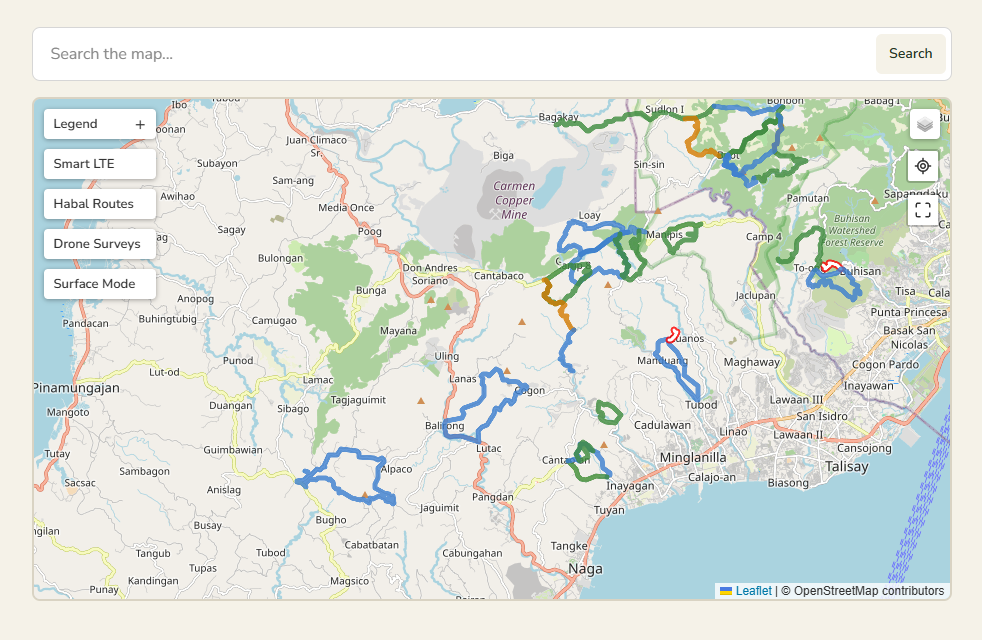
The beesayatv Trail Atlas combines documented hiking routes, field observations, and supporting map information into a single interactive map.
The following features are available within the Atlas.
- Interactive Cebu trail map — Displays documented hiking routes across Cebu on an interactive map.
- Map basemaps — Switch between Map, Satellite, and Topographic views. Your selected basemap is remembered for future visits.
- Focus Mode — Selecting a trail highlights the active route while reducing the visual emphasis of unrelated routes.
- Route details panel — Displays summary information and provides a direct link to the corresponding Trail Report.
- Adaptive route styling — Route lines adjust their appearance to remain visible across different basemap styles.
- Trail segmentation — Some documented routes are divided into segments to better represent difficulty changes and improve readability.
- Direction chevrons — Show the documented direction of travel for a selected route; they are not turn-by-turn navigation.
- Start and end markers — Identify the recorded beginning and end of a selected documented route.
- Trail search — Quickly locate documented trails from the Atlas search box.
- Standard POIs — Persistent locations, such as transport-related points, remain visible independently of route selection.
- Context POIs — Field-documented locations associated with a selected trail, including water sources, stores, houses, campsites, and similar route context.
- Habal-habal routes layer — An optional layer of documented motorcycle-access routes to help reach trail areas.
- Smart LTE connectivity layer — Field-recorded Smart LTE service observations displayed at their recorded geographic positions.
- Surface Mode — An alternate map representation that replaces documented hike routes with the approved physical Surface Network.
- Canonical Surface Network — Surface Mode shows one curated representation of each physical path rather than stacking duplicate GPX tracks from multiple Field Sessions.
- Surface classifications — Surface Network segments distinguish Trail, Unpaved Road, and Paved Road using the reviewed surface palette.
- Surface evidence and review — Canonical surface segments retain source-session provenance and observation dates; conflicting or uncertain observations are held for editorial review rather than resolved automatically.
- Independent overlays in Surface Mode — Smart LTE, habal-habal and drone survey layers remain available while Surface Mode is active.
- Drone Surveys layer — An optional layer showing published aerial surveys at their representative geographic locations.
- Synchronized flight paths — Selecting a Drone Survey marker displays its recorded flight path using the survey’s confirmed telemetry. Select the marker again, or click elsewhere on the map, to hide the path.
- Zoom-aware flight-path styling — Drone Survey flight paths use dashed lines that adjust their weight and spacing according to the current map zoom.
- Legend — Explains route colours, surface classifications, markers, and other map symbols.
- Locate Me — Uses your device location, with permission, to center the map near your current position.
- Explorer Mode — Expands the Atlas into full view for more immersive browsing, particularly on smaller screens.