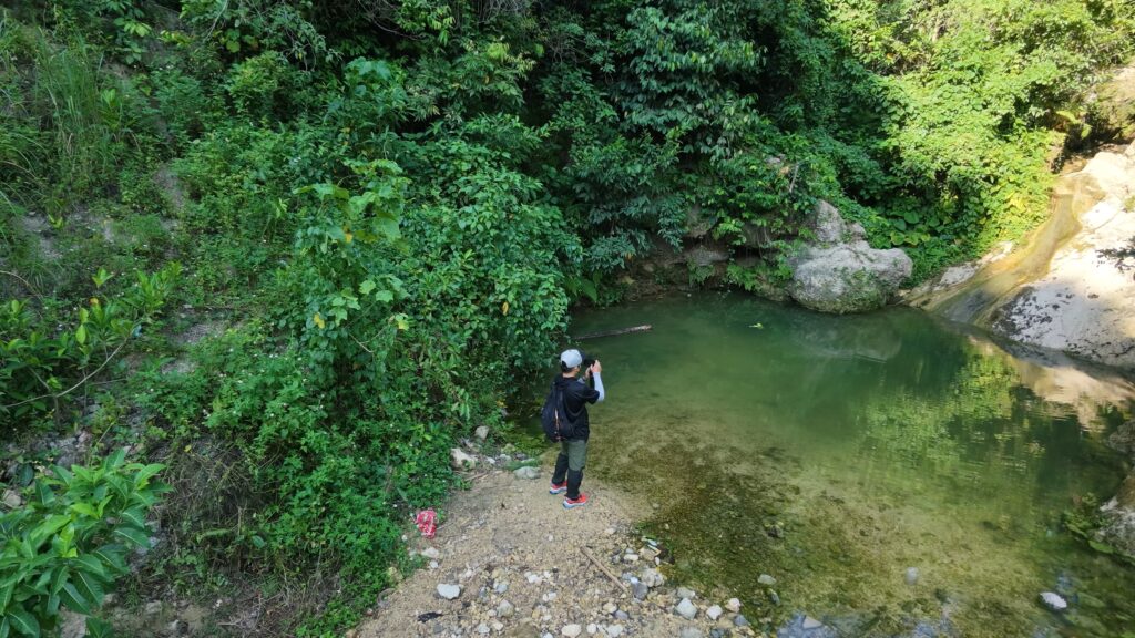
Trail documentation often focuses on the most recognizable parts of a hike: mountain peaks, waterfalls, panoramic views, and memorable destinations. While these are valuable, they represent only part of a trail’s character.
A trail also passes through farmland, residential areas, exposed slopes, shaded footpaths, and ordinary stretches of landscape that may seem unremarkable. These places are equally part of the hiking experience, even when they are less visually appealing.
Trail realism is the practice of documenting trails as they are encountered in the field, preserving their actual conditions, surrounding environments, and overlooked details.
For beesayatv, it is a principle that guides how trails are observed, recorded, and presented.
What Trail Realism Means
Trail realism does not mean documenting every step or avoiding beautiful footage. It means allowing the actual character of a trail to remain visible.
A waterfall may be the destination, but the footpaths, vegetation, streams, and terrain along the way are part of the same environment. Uneven ground, muddy sections, exposed paths, agricultural activity, and the presence or absence of shade can all help describe a route.
These details are not distractions from the trail. They are part of what makes each trail distinct.
It also means distinguishing direct observations from assumptions. Documentation becomes more reliable when it records what can be observed and acknowledges what remains uncertain.
Why Trail Realism Matters to beesayatv
beesayatv is a field documentation project focused on Cebu’s trails and their surrounding environments. Its purpose extends beyond presenting destinations or showcasing scenic locations.
Trail realism shifts the focus from the destination alone to the entire route and the environment through which it passes.
This principle connects beesayatv’s different forms of field data. GPS tracks establish recorded routes. Points of interest identify features encountered along the way. Trail reports describe observed conditions, while photographs and videos preserve visual evidence. Connectivity measurements and other field observations add information that scenery alone cannot communicate.
Together, these records build a more complete account of Cebu’s trails.
Why It Matters in Trail Documentation
1. It preserves overlooked details
When documentation focuses exclusively on scenic highlights, the surrounding environment can disappear from the record. Recording ordinary sections of a trail provides context and helps preserve what a route is actually like.
2. It documents changing conditions
Trails change through rainfall, vegetation growth, erosion, agricultural activity, and human use. Records from repeated visits can help identify differences over time, even when the reasons for those changes are not immediately clear.
3. It provides context beyond scenery
Terrain, shade, water sources, vegetation, nearby settlements, and route surfaces all contribute to understanding a trail. These observations make documentation more informative than scenic imagery alone.
4. It creates a record that can be revisited
When photographs, GPS data, and field notes are associated with identifiable locations, they can support future comparisons. Each visit can confirm earlier observations, reveal changes, or add information to an existing record.
Over time, individual field visits can become part of a larger documentary record.
How beesayatv Applies Trail Realism
beesayatv’s Trail Atlas, trail reports, photographs, videos, and field measurements document different aspects of the same environment.
The Trail Atlas records routes and geographic information. Trail reports describe characteristics encountered during fieldwork. Photographs and videos preserve visual context, while additional observations, such as cellular connectivity measurements, document conditions that may not be visible on camera.
Each record has its own purpose, but all are grounded in actual places and field observations.
An ordinary footpath does not need to lead to a famous destination to be worth documenting. A stretch of farmland, a small spring, a change in terrain, or an otherwise unremarkable section of trail can contribute valuable context to the larger record.
The objective is not to make every trail appear exceptional. It is to document what makes each trail what it is.
Building a Documentary Record
Trail realism recognizes that no single visit can capture everything about a trail. Weather, access, equipment, and the scope of fieldwork all influence what can be recorded.
A GPS track cannot describe every environmental condition, just as a photograph cannot establish how a trail changes throughout the year. Reliable documentation depends on preserving available evidence, identifying its limitations, and avoiding claims that go beyond what was observed.
As records accumulate, repeated visits can reveal changes, fill gaps, and deepen the understanding of individual routes and their surroundings.
For beesayatv, trail realism connects these efforts through a consistent principle: document the actual trail, preserve its context, and let field evidence guide the story.
The goal is not to present trails as more beautiful, difficult, or interesting than they are. It is to preserve an honest account of what was encountered, including the ordinary details that might otherwise be forgotten.