The Cabanbanan Community Trail Loop is a documented 8.34 km loop hike in Toledo City, passing through Camp 7, Canapnapan 2, Canapnapan 3, Cabanbanan, and Upper Camp 8. I followed a straightforward community route with steady climbs, rolling farmland, mountain views, and quiet rural roads before returning to the starting point.
Although navigation remained simple throughout, the continuous ascents and longer distance made the hike more physically demanding than the terrain itself. I completed this hike in June 2026.
Trail Snapshot
Access
I started near Camp 7 National High School, where motorcycle parking was available along the roadside without a parking fee. The jump-off was accessible by a mix of concrete and dirt roads, and private vehicles could reach the area. Public transportation was limited, although habal-habal services were available. The parking area was about 2 km before the junction leading to Canapnapan 2.
Why this trail is rated Mild
Route Description
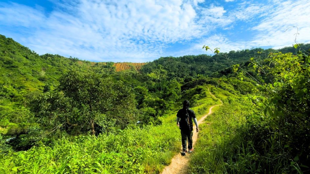
I began by following community roads and trails toward Canapnapan 2 before continuing through Canapnapan 3, Cabanbanan, and Upper Camp 8. The route passed rolling farmland, open countryside, and several residential areas where I frequently met local residents. Navigation stayed straightforward from start to finish, with the steady climbs providing the main physical challenge rather than any technical terrain.
As I continued around the loop, several sections opened up to wide views of the surrounding mountains before the trail gradually returned to the starting point. I also passed many dogs along the route, especially near homes, and kept a comfortable distance while walking through the communities.
Trail Conditions
The weather remained sunny throughout my hike. Much of the route was exposed with limited shade, although I found several stores whenever I passed through local communities. The trail stayed dry during my visit but could become very muddy after rainfall. Mobile signal was strong near the start before becoming intermittent in some areas. I encountered many people throughout the hike and noticed only a few insects.
Additional Notes
This route passed through established communities rather than remote mountain terrain, and the locals I met, especially the children, were friendly and helpful. Hiking the loop in the opposite direction would turn the section from the road junction toward Cabanbanan into a long, continuous climb.
A hiking stick or trekking pole can also be useful for anyone who is uncomfortable walking past the many dogs found along the route.
Continue exploring
Data sources: Field Documentation · Open-Meteo Forecast