The Danasan Falls Trail Loop is a documented 5.84 km loop hike in Danasan, Danao City. I followed the longer approach before descending to Cantaling Falls, which some maps also label as Danasan Falls, then returned via a sustained uphill climb to complete the loop. The longer route offered gentler terrain before joining the same ascent used by the shorter direct route. I completed this hike in June 2026 under sunny morning conditions.
Trail Snapshot
Access
I started near Danasan Elementary School, where motorcycle parking was available along the roadside without a parking fee. The roads leading to the jump-off included a mix of concrete, paved, and dirt sections. Private vehicles could reach the area, while public transportation was very limited.
Habal-habal services were available, and local fares from Danao City proper to Danasan Elementary School typically ranged from ₱300 to ₱500 per person, with lower fares possible when sharing a ride. The waterfall is about 28 km from Danao City proper, and the trip usually takes around 45 to 60 minutes by motorcycle or private vehicle.
Why this trail is rated Mild
Route Description
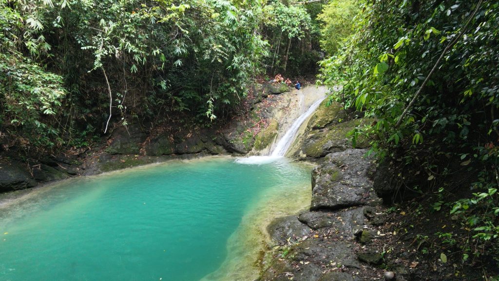
I chose the longer loop instead of the shorter direct route to the falls. The trail was easy to follow, and I regularly crossed paths with other hikers throughout the day. After reaching Cantaling Falls, I began the return climb using the same uphill section shared by both routes.
The trail included sustained ascents and descents, along with several rocky and uneven sections underfoot. I also crossed a number of manageable river crossings before continuing back toward the trailhead. The final climb was the most demanding part of the hike and continued steadily until I returned to the starting point.
Trail Conditions
The weather was sunny throughout the morning. I walked through a mix of shaded and exposed sections, while the trail remained dry during my visit. I found stores only near the communities at the beginning of the hike. Mobile signal started out strong but disappeared farther along the route, and insects were minimal. Because this is a popular waterfall trail, I encountered many other hikers during the day.
Additional Notes
When I arrived at the jump-off, several local guides, mostly children and teenagers, approached me and offered guiding services to Cantaling Falls. Their fees were negotiable. The shorter direct route to the waterfall covers about 2 km and is mostly downhill, but it requires a river crossing that can become difficult or inaccessible after heavy rain. I also noticed that some maps and GPX sources identify the waterfall as Danasan Falls, while recent local usage and hiking content commonly refer to it as Cantaling Falls.
Continue exploring
Data sources: Field Documentation · Open-Meteo Forecast