The Radar Trail is a documented 5.42 km point-to-point hike that starts in Sudlon 1, Cebu City, and descends to Bagakay, Toledo City. I followed a mostly downhill route along a mountain ridge, passing through farms, small mountain communities, and open countryside before finishing at a bridge over the river that flows into Malubog Lake.
The trail was generally easy to follow, although a few sections became less obvious where farmland overlapped the route. I completed this hike in June 2026.
Trail Snapshot
Access
I started near the Sudlon 1 Barangay Hall, where motorcycle parking was available along the roadside without a parking fee. The jump-off was accessible by concrete road, and private vehicles could reach the area. There was no public transportation available, although habal-habal services operated in the vicinity.
Why this trail is rated Easy
Route Description
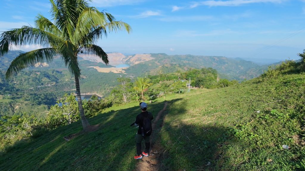
I began the hike by following the mountain ridge toward Bagakay. The trail passed through narrow footpaths, farms, small mountain communities, and more open sections with views across the surrounding countryside. Most of the route descended steadily, making for an easy walk overall, although the continuous downhill sections became harder on my knees as the hike progressed.
The path remained well-trodden for much of the hike because locals and livestock regularly used it. Even so, I came across several side trails, and a few sections became confusing where farmland overlapped the route. In those areas, I had to look for where the trail continued before carrying on toward the finish. The hike ended at a bridge crossing the river that flows into Malubog Lake.
Trail Conditions
The weather was sunny during my hike. I walked through shaded sections early on before the trail became more exposed near the end. The ground was dry throughout my visit, although it could become muddy during rainy weather. Mobile signal started out strong but disappeared farther along the route. I did not find any stores along the trail, encountered no other hikers, and noticed only minimal insects.
Additional Notes
The steady downhill descent made a trekking pole useful, especially on the uneven and occasionally rocky sections. Hiking the route in reverse would turn the descent into a sustained climb lasting several kilometers. Although the trail was easy to follow most of the time, the network of side trails and farmland crossings occasionally required extra attention to stay on the intended route.
Continue exploring
Data sources: Field Documentation · Open-Meteo Forecast