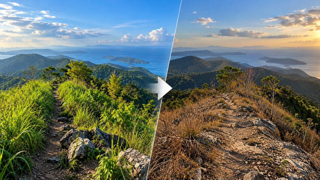
A hiking trail provides a view of a landscape at a particular time. But landscapes change. Vegetation grows, trail conditions deteriorate, and human activity alters the surroundings. Documenting these changes requires returning to the same locations and recording new observations.
Delta Tracking extends beesayatv’s field documentation by connecting photographs of specific locations across multiple visits, creating a visual record of how the landscape changes over time.
Recording Repeat Observations
Using photographs collected through the beesayatv Field Logger, Delta Tracking connects field observations to geographic locations. Photographs from different field sessions can be matched to previously documented locations, allowing new observations to be compared with earlier records.
This turns individual field photographs into a chronological record rather than leaving them as isolated images from separate hikes.
Connecting Photographs to the Map
Curated Delta Tracking records appear as markers in the Trail Atlas. Selecting a location allows users to explore its photographic history and compare observations from different visits.
These records can help document visible changes in vegetation, trail conditions, and surrounding landscapes. Each return visit adds another observation, gradually building a visual history of the documented location.
Extending Field Documentation
Delta Tracking builds on beesayatv’s existing field data collection workflow. The Field Logger collects photographs and geographic reference points, while the Trail Atlas provides the map and the means to explore curated observations over time.
Its purpose is to extend trail documentation beyond mapping where places are located to recording how those places change. As more field observations accumulate, Delta Tracking can provide a growing record of the landscapes documented through beesayatv’s fieldwork.
Explore the Trail Atlas Features for more information.