The Buot Brgy Hall–Sitio Tabla Community Trail is a 3.34-kilometer point-to-point route from Buot-Taup Barangay Hall toward Sitio Tabla in Cebu City. I hiked it in October 2026, initially planning to complete a loop, but the constant ascent toward Sitio Tabla and the time spent documenting the route slowed my pace enough that I decided to end the hike there.
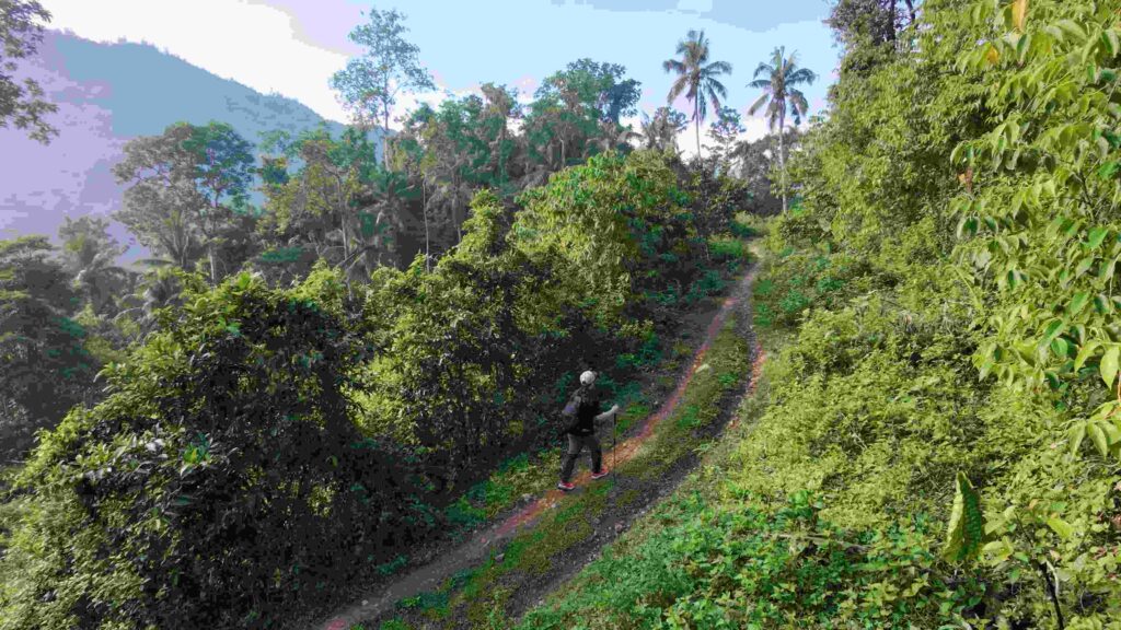
Most of the route was on trail, with limited shade because of farming on the slopes. The route passes through areas where crops are extensively cultivated and where I encountered livestock, dogs, and mostly local users.
Trail Snapshot
Access
I parked my motorcycle near the suspended bridge at Buot-Taup Barangay Hall, with no parking fee. Road access to the area is mixed. Public transportation is limited, but habal-habal service is available, as is private vehicle access.
After reaching Sitio Tabla, I hired a habal-habal to take me back to Buot Barangay Hall, where I had left my motorcycle. The fare was ₱150. I have not yet documented the return route between Sitio Tabla and Buot Barangay Hall, so that section will be covered on a future visit.
Why this trail is rated Tough
Route Description
I started early with the intention of completing the hike as a loop. My pace was slower than usual because I was documenting the route while dealing with the constant ascent toward Sitio Tabla.
Since this was my second visit, finding the route was considerably easier. Some sections were clear and well-trodden, while other portions passed through cultivated areas. I also came across several new diversion routes.
Much of the route passes through farming areas, with tomatoes, ampalaya, and kamote among the crops being extensively cultivated on the slopes. The route itself was dry during this visit, and the morning shifted between cloudy and sunny conditions.
Trail Conditions
Shade was limited, particularly across the cultivated slopes. There were no stores along the route, and I encountered mostly local users.
Ant activity was particularly noticeable early in the hike. Along the route, I also came across several cows, goats, and carabaos grazing on the slopes and, in some places, directly along the route.
Several territorial dogs were present as well, although most were friendly. I cannot confirm why the dogs behaved this way, though I noted that the route is regularly used by hikers.
The route was approximately 98% trail and 2% road during this hike. In terms of water, I carried the equivalent of at least 2 liters.
Notes
The route does not involve dangerous cliff exposure. However, the combination of sustained climbing, limited shade, and cultivated sections made the ascent toward Sitio Tabla slower for me on this visit.
I ultimately changed the planned loop into a point-to-point hike and ended at Sitio Tabla, returning to Buot Barangay Hall by habal-habal rather than completing a loop hike.
Continue exploring
Data sources: Field Documentation · Open-Meteo Forecast