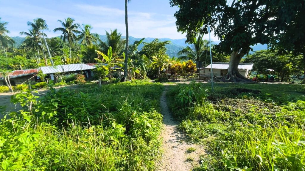
Hiking trails are often imagined as routes that leave towns behind and disappear into the mountains. Across many documented hikes in Cebu, a different pattern appears.
Instead of passing through isolated wilderness from beginning to end, many routes follow footpaths that local residents use every day. The same trail walked by hikers may also connect farms, hillside homes, neighboring sitios, and agricultural land.
For local communities, these paths existed long before they became hiking routes.
Trails Shared With Everyday Life
This pattern appears across different parts of the current trail archive.
The Campagao Community Trail Loop passes hillside homes, open countryside, and well-used local footpaths. The Cabanbanan Community Trail Loop moves between farmland and rural communities, while the Guindaruhan–Estaka Trail Loop follows paths that residents use as a shortcut around Cutod Falls.
Elsewhere, the Bitlang Trail descends through farms and mountain communities before reaching the valley below, and the Camp 8 Backtrails spend much of the walk on agricultural footpaths rather than isolated mountain trails.
Although each route is different, they share the same characteristic: hikers are often walking along paths that remain part of everyday community life.
Why These Trails Exist
Many of these routes were not created for recreation.
They provide practical access between farms, homes, grazing areas, neighboring sitios, and other destinations used by local residents. Because of that, hikers may share the trail with farmers, motorcycles, livestock, or children walking to school, depending on the location and time of day.
Rather than separating hikers from the surrounding community, these trails often place them within it.
Looking at Cebu’s Trail Network
Taken together, these examples suggest that much of Cebu’s hiking network is closely connected to the communities around it.
This does not mean every hike passes through populated areas. Forested sections, quiet ridges, and more isolated landscapes remain part of many routes. Yet across the documented archive, community footpaths appear often enough to become a recurring feature of the hiking environment.
Understanding that connection helps explain why many Cebu hikes feel different from the idea of a trail leading only through untouched wilderness. Instead, they often move between farms, homes, forests, and mountain viewpoints as part of a single continuous walk.
Not Every Trail Follows This Pattern
These observations reflect the routes currently documented in the beesayatv archive.
As additional municipalities and trail networks are explored, different patterns may emerge. The examples here describe recurring characteristics found across the documented hikes rather than every trail in Cebu.